
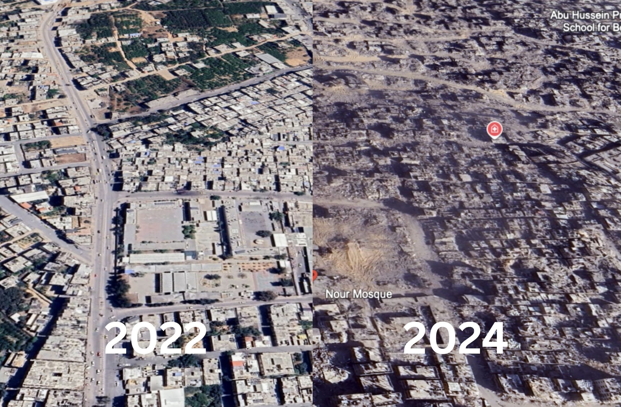
In Google Earth maps we can see how the Gaza strip has changed directly from the satellite. The bombarded areas are covered with a layer of dust. Entire neighborhoods have been razed to the ground. To see how the Gaza strip was first, just scroll through the photos back in time.
In recent months, Google Earth has begun to update satellite maps of the Gaza Strip. The insertion of new images in the Google portal dedicated to the satellite images is started in early Februaryas the US version of Mashable reported. Here we leave you the latest testimonies reported to Fanpage.it by the Gaza Strip. The last operation of the Israeli army has started in the last few days here: Gedeone wagons.
It is not an operation that takes place regularly. Satellite updates by appealing from placefrom the amount of information and also by the policies applied by the platform. Not only that. It also depends on how many satellite images They are in the archive. The sequence of the satellite images of Rome begins in 1984 and is updated year after year until 2020.
Gaza’s timeline is different. The first image is from 1985, with a very low level of definition. The second is from 2004 and the shape of the buildings is already glimpsed. Those after they arrive years later: 2007, 2011, 2016, 2016, 2019, 2020, 2021, 2022 and 2023. The updates here become more numerous, up to the last: 1 December 2024.
Died under the Israeli bombs Mohammed at Sultan: he trained the football school in Gaza despite the war
The image of Gaza after the bombings of the Army of Israel
If we look at the images from the top of the Gaza Strip we see well the degree of devastation reached after i bombings of the Army of Israel. Everything is covered by a layer of dust. The roads, the land and neighborhoods have colors ranging from gray to the OC. The paved roads look like white paths. And above all whole buildings are razed to the ground.
We have aimed for Google Earth’s lens in the cities entered in recent months in newspaper. Starting from the south we find Rafah, a city on the border of the Gaza Strip where entire neighborhoods seem to be returned to the desert. Between November 2023 and June 2024 it seems to see different cities.
We leave you under Two photor. The first shows an inhabited city. There are cars on the street, many houses with different roofs and areas with trees. Nothing has remained in the second. The streets are full of the rubble. Buildings completely destroyed. And from here we cannot see the conditions of those who remain.
The photographic comparison between before and after
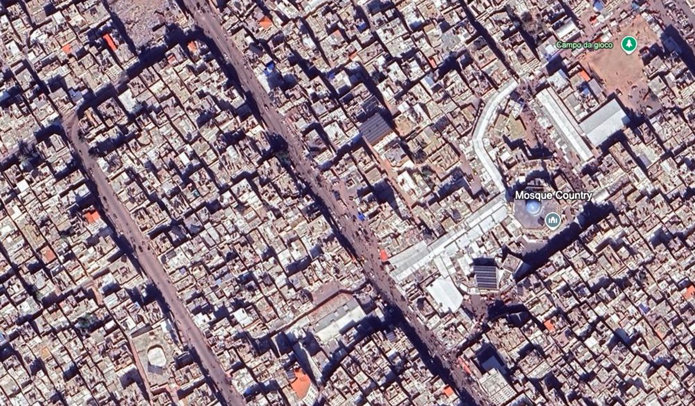
Google Earth | Rafah in 2023
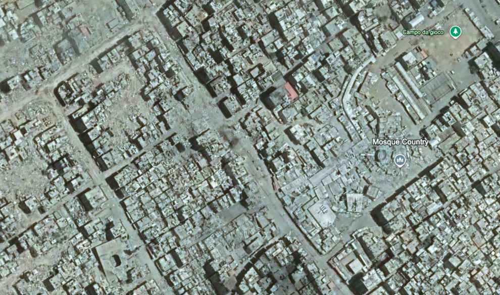
Google Earth | Rafah in 2024
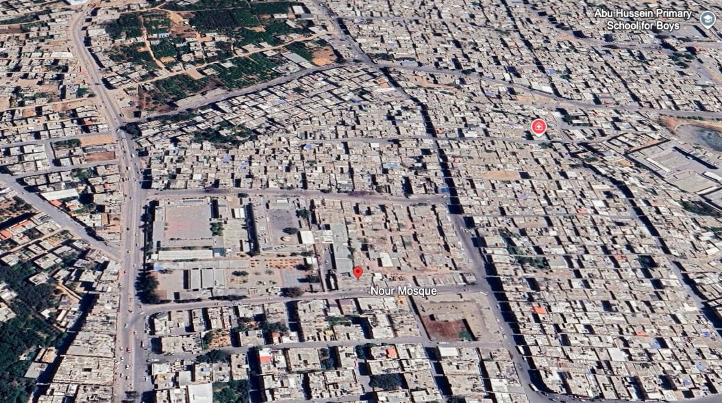
Google Earth | Jabalya in 2022
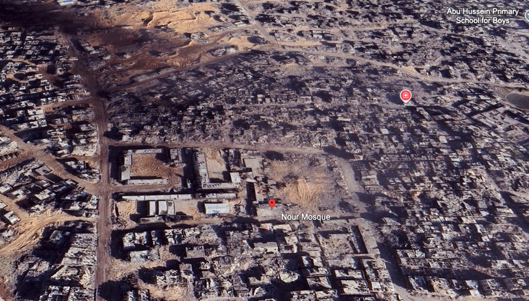
Google Earth | Jabalya in 2024